Developers have submitted drawings showing the proposed layout of up to 500 homes they want to build on agricultural land north of Dorchester.
The first phase of the North Dorchester Garden Community is slated to spring up on 24.5 hectares of land west of A35 and east of Slyers Lane.
The aim is for the Stinsford Hill Neighbourhood to be a new village on the eastern side of the Garden Community.
This is the first neighbourhood of the wider North Dorchester Garden Community and it is projected to be completed in 2033.
The entire Garden Community – all 3,500 homes – is estimated for completion in 2048.
For this phase, existing housing along London Road and surrounding streets would directly border the new development.
The plan shows the primary vehicular access coming off Coker’s Frome Lane, with an emergency-only secondary access.
There is also a relocated agricultural access, meaning existing farm vehicle movements would be redirected.
Slyer’s Lane could be realigned to a new junction on London Road.
A Reserved Matters application for detailed design is planned for late 2027 and construction could start in summer 2028.
Housing
The first homes and community facilities should be available in early 2029.
The site is divided into zones with different building heights. Most of the development would be 2.5 storeys (up to 9 metres ridge height), with some areas of 3 storeys (up to 11 metres) and some 4-storey blocks (up to 14 metres).
325 homes would be market-rate housing and 175 would be affordable for renting, shared ownership and discounted local sale.
The 500 homes would be all-electric, with heat pumps, solar panels and EV charging built in.
The planning application, submitted by Derwent Developments, a subsidiary of national housebuilder Grainger Plc, is for outline permission only.
Appearance, landscaping, layout and scale are all reserved for later planning applications – so residents won’t yet see final designs.
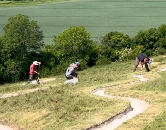
The land is currently working farmland – fields, paddocks and tracks, with long-established 18th-century enclosure hedgerows.
Ecology
Bee and swift bricks would be built on every house for insects and birds to nest in.
The development design includes wildflower meadows, hedgehog highways, bat boxes, community orchards and allotments.
Wildlife confirmed on site includes great crested newts, badgers, bats, hedgehogs, brown hares, grass snakes, breeding and wintering birds, and potential for hazel dormice, otters and water voles.
Developers aim to increase biodiversity and have built in a number of mitigations in their environmental reports.
Community features
includes a village green with community pavilion, pub, nursery, shops, allotments, orchard, play spaces and kickabout area.
There will be sports pitches,1,500 new trees, and a health hub.
A solar-powered ‘interpretation bench’ will provide wi-fi and phone as well as interactive resources covering the history of Dorset, Kingston Maurward, Dorchester, the ecology of the water meadows, and Thomas Hardy.
And one of the proposals is for a minimum of one bus every 30 minutes into Dorchester town centre.
However, developers acknowledge the scheme is not popular with residents who fear flood risk and transport chaos amid other issues.
Flood risk
The land earmarked for development slopes down 20 metres south toward the River Frome.
The application contains relatively little detail on flood risk – partly because appearance and drainage specifics are reserved for later.
The site is not identified as being within a flood risk area. It is however within 20 metres of the River Frome which is clearly shown running along the southern edge of the site boundary.
Developers say the proposal is not expected to increase flood risk elsewhere.
Surface water disposal
The plan is to use a sustainable drainage system (SuDS), which is the modern standard approach for large developments – it uses features like swales, ponds and permeable surfaces to slow water runoff rather than pushing it straight into drains.
Because this is outline permission with most matters reserved, the detailed drainage design hasn’t been signed off.
The foul sewage would connect to the mains sewer, but again the specifics are deferred.
Planners’ maps show both Flood Zone 2 and Flood Zone 3 running along the southern portion of the site following the River Frome.
Flood Zone 3 is the highest risk category – land assessed as having a 1 in 100 or greater annual probability of flooding.
The housing would need to be kept clear of these zones, which is why the southern portion of the site is shown as open space in the masterplan.
The site sits over or near a groundwater source used for drinking water. Any contamination of the ground could affect the water supply.
Education
If planning permission is granted, the developer would be legally required to pay money to Dorset Council toward the cost of expanding or improving school provision in Dorchester to accommodate the children who would live in the new homes.
A primary school will be considered in the next phase.
Site
The site sits between the A35, Stinsford Hill, London Road and Slyer’s Lane – there are existing roads with homes and farmland nearby.
The River Frome flows along the southern edge of the site and the A35 runs along the northern boundary.
The archaeology section confirms the line of the Roman road from London to Dorchester via Stinsford runs along the eastern boundary of the site, evidenced by excavation and the discovery of a Roman milestone.
Kingston Maurward College is approximately 1 km away to the east.
Thomas Hardy’s heritage and legacy
The water meadows, valley views, heritage landscapes, the River Frome are all literary associations linked with Thomas Hardy.
Stinsford is Hardy’s Mellstock; Kingston Maurward is his Knapwater House, and the Frome water meadows are his Vale of the Great Dairies.
The Hardy Way runs right through this planned development.
Marked as a long-distance path, it passes along the southern boundary of the development at Stinsford Hill.
Hardy pilgrims walking this route between Stinsford churchyard and Grey’s Bridge will walk past a housing estate if the plans get the go ahead.
The plan proposes a “potential Hardy wayfinding feature” at the entrance – a piece of public art to acknowledge Hardy’s heritage and legacy.
The village of Stinsford sits immediately to the northeast of the site and Stinsford Church has Thomas Hardy’s heart buried there.
The development would effectively bring the edge of Dorchester up to the village boundary.
The scheme is planned to be immediately adjacent to Birkin House, a historic Victorian country house in Stinsford.
Mohan Sidhu, Associate Director for Grainger plc, said: “This is the moment where a long-held vision begins to take tangible shape, moving from discussion to delivery.
“Submitting this first planning application for the North Dorchester Garden Community is a hugely significant milestone and the culmination of many years of planning, technical work, consultation and careful refinement as the proposals have evolved.”
You have until 24 July to comment on this planning application. Go to https://planning.dorsetcouncil.gov.uk/ and search for planning application number P/OUT/2026/03215